Couple weeks ago I made mention of wanting to return to the Old Dale Mining District in Joshua Tree. There was something about that dirt road snaking through the valley leading into the mountains that stuck with me. Candace and I are very much into old mining history and exploration, so this are would be perfect for a weekend getaway.
Spent some time since then researching, planning and mapping the area out. While the trail starts off in the Joshua Tree National Park, it eventually dumps into BLM land at the foot of the hills. This is great as there are no more restrictions on campfires, allowable camping areas and best of all, less people. While it might not be a problem for most, the idea of being crammed in a designated campsite next to others or spend a night without a fire isn’t for me, so the public land was welcoming.
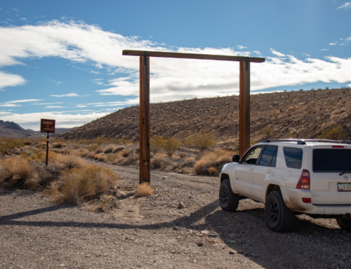
Chances of thunderstorms and scattered rain kept us from leaving until Saturday morning. Quickly loaded the truck up and set off to enter the park through Cottonwood Springs.
Our first stop was the Mission Mine, just outside the parks boundaries. From what I gathered, this mine was worked as recent as the 1980’s, and not long ago much of the structure and equipment was still operational and intact. The main shaft was vertical and workers used a elevator to access the lower level of 650 ft.

After leaving the Mission Mine, the reason for the “4 Wheel Drive Road” became apparent. The Tacoma made short work of the hilly mountainside, leading us to Sunset Mine. Another vertical shaft, with the entrance right below this structure. Guessing this is where they housed whatever motor/pulley setup to extract the ore.
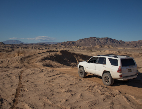
We continued on towards the northern parts of the mining district. Most of it was slow going 4 wheel drive shelf type roads. The top of the mountain provided a view of the valley that we would end up later in the day.

Our next area to check out was the OK Mine. The road leading there was the first time I had to switch the Tacoma into 4-low and set the rear locker. Although it’s well traveled, there was a few sections that didn’t leave much room for mistakes, but it was nothing compared to what was waiting for us later in the day.
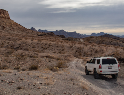
After taking a break, eating lunch and exploring the area and structures, we set off down BLM Open Route #1937. This wouldn’t have been a big deal other then the fact we were alone. The road followed a narrow ravine, that gradually got rougher, washed out and required careful tire placement at multiple points. Only grabbed a couple of pictures when my knuckles weren’t white, and they don’t show the sketchier parts.
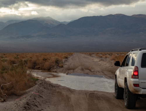
Thankfully, the road managed to keep together enough to get us down to the final valley of our trip. It was a nice sight seeing flat, open desert after having my nerves rattled a bit. Once at the bottom, we turned onto wash to check out the Gold Rose and Rose of Peru mines.

Found this in the side of the mountain. Not a soul in sight, no footprints or tire tracks other then our own, yet it looked like someone is/was here.
It was getting late in the day, still had a bit of driving to do so we started towards where we would be camping for the night. Found a killer spot near a mine that had a few abandoned cars and a nice view.
Woke in the morning to a buzz. Not the good kind, but bees. Bees everywhere. (Insert Oprah bee gif). We set a personal record packing up camp and somehow managed to avoid getting stung. There must have been a nearby hive as there were hundreds of them and more coming by the minute.
The trail leading back was short and uneventful until noticed a odd shaped, moving rock…

This guy looked ancient, much rougher and worn then the one we saw during the Mojave Road. We backed up and made a large detour around to keep from disturbing him.
Unable to make breakfast back at our camp, we pulled over near where we started our adventure the day prior. Candace whipped up a egg, potato & cheese concoction.
We hopped back on Pinto Basin Rd and decided to take a quick tour of Joshua Tree before heading home.
The Old Dale Mining District is definitely one to check out. Whether it be for the mines or numerous trails of varying difficulty. There is enough to explore that you could spend days in the back-country. We plan on coming back in the near future to check out the areas we didn’t have time for this trip and to enjoy the quietest and less-known portion of Joshua Tree.
Until next time!


Hi Kyle,
I just stumbled upon your blog and Old Dale was the first article that jumped out. It’s a wonderful area, and you’ve done a great job capturing it. We woke to the same bee-pocalypse last time we camped out there, just over the hill at the Gold Rose Cabin. Water is scarce, so they’ll flood in from miles away at the mere scent of it. They were stacked so deep on the spout of our water jug they were falling off of it. A bit of campfire smoke pacified them enough to get the jug back and drive on (after packing everything else up first, of course).
Gold Rose Cabin is actually open for camping, and it’s a great place to stay. It’s set up as an adopt-a-cabin style system, and travelers are welcome to stay as long as it’s left as it’s found. There’s a group of locals that maintain the place and add additional features from time to time (like that new patio extension and ramp down to the road/wash). If you ever make it back out that way check under the stove and you should find a log of visitors, maintenance, etc.
Happy trails, hopefully we’ll see you out there sometime.
Enjoyed your blog and especially the pictures of the Gold Rose. I lived there with my family in 1955/1956 when I was just a sprout. The Gold Rose “Cabin” was our old bunk house and was originally built prior to World War I.
Awesome! Glad you enjoyed the read!
We actually just finished up a trip this weekend and stayed the night there Friday. It worked out great for us and the young one’s loved being able to run around and have a safe place to play. We cleaned up and left what we could for the next person that uses it.
I’ll have a trip report up in the next couple weeks with updated pictures, a lot of them focused on the “cabin” itself.
Thank you for visiting and leaving a reply!
Hi Kyle et al
Visited the Old Dale mines in January 2016 and things are pretty much as you describe them. It must have been a bit cool for bees as I saw not one! Driving an FJ cruiser, not lifted but with good Mickey Thompson MTZ’s and underarmor so it was okay. My favorite was getting back to the Brooklyn mine, definitely took some careful wheel placement. If I’d known I could have taken a couple of timbers in for the Brooklyn cabin roof as it’s also kept up by a variety of nice folk.
Hans
Calgary, Canada
Kyle – I enjoyed your trip to the Peru mines – I used to go out there in the mid-60’s with my uncle who with a group of other LA cops had “ownership” of the Rose of Peru. I was a teenager at the time – we stayed in a cabin that as I remember was in very good shape – we rode dirt bikes, shot guns, explored the area and set off explosives – great fun for a kid! An old miner named “Carl” used to live out there as a caretaker and was doing some prospecting. We drove out from 29 Palms in a ’56 Ford pickup leaving his family staying in a motel with pool to await our return. Would like to visit again some time in the future – your trip brought back come great memories – thanks!
On my blog site Westernsnowbirds.com
I have an extensive collection of photos of the Old Dale district taken in 2015. I visited pretty well all the mines.
Just spent a week basecamping out of JTNP. Wish someone could tell me the name of the mine that had the old cars where you camped out with the bees
My wife found your blog looking to find more info on stuff in cabins out there. Both the one you posted here and one up the canyon or over the hill. Very well kept. Brooms and home made chimney. Very interesting/intriguing/spooky. Need to go out again and expore other mines in area. Just went 2/16/18
Hi Kyle (and anyone else)!, I have a decent amount of novice experience in the “Supply Mine”. I have been going in that mine from the time I was 18 (1995), and I have been all the way down to level 6. Would love to connect with anyone that has been inside or is wanting to go inside. Additionally, I was just in there this last weekend (April 27, 2024).
Notes:
The main shaft has horizontal safety lines across it that were installed by another individual in 2019, which seem secure.
The first ladder (183 rungs, approximately 200ft down) is in excellent condition and looks like someone (likely the 2019 group) did some repairs.
The second ladder is in need of repair (I made the safety decision to turn back in my 2023 visit, but came with gear to overcome this section in 2024). I did do some repairs of the second ladder (April 24′), and will do so again the next time I am there, but really would like to pull in other like minded people to help in the effort. The is a middle section of the second ladder that is literally tied to the ladder above it and dangling over about a 15-20 vertical section. I brought with me a 13mm static climbing rope, which I left behind for others to use. Anyone attempting this next section should bring harnesses, ascenders, wood for replacing horizontal ladder steps, but the biggest thing is webbing that is needed to secure the hanging ladder section to the beam that is right there.
Mine levels 2, 3, and 4 are really more of ladder transitions than actual levels.
Mine level 5 is where things are interesting, mine cart tracks, holes in the ground, another ladder section that is incomplete but you can climb down to level six going from beam to beam. I have always felt like you hit fresh air on level 5, and I have always thought there must be a connection (there is another known potential entry point on the back side of the hill/mountain, but not safe enough to attempt to descend that route). Level 5 still has a lot of holes, that lead to other passages, that I would like to explore to try and find the connection point. If anyone is going to attempt to find connection points via level 5 should bring another static rope, harnesses, ascenders (and know how to use them).
Level 6 you will find an old mine cart, but it comes to a big open cave that looks to be caved in.
Nice story and photos. Thank you.